|
Bassin de la Sanaga
|
||||
|
|
||||
|
RAPPEL : Le téléchargement de données est libre moyennant un enregistrement sur ce site et l'édition et le renvoi de la déclaration de l'utilisateur signée.
|
||||

|
||||
|
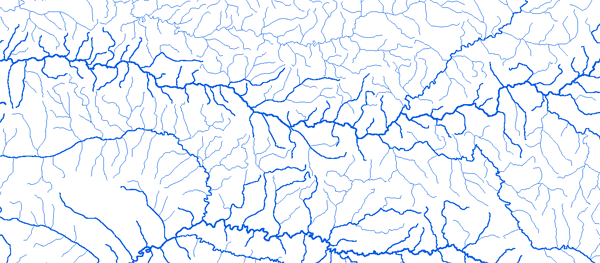
La Sanaga |
 |
|||
|
Au Pont de Magba 11°16'01"E 05°59'01"N |
 |
 |
 |
 |
|
Bac de Goura 11°22'01"E 04°34'01"N |
|
|
|
|
|
Bafoussam II 10°33'01"E 05°28'01"N |
|
|
|
|
|
Betare Oya 14°01'29"E 05°37'54"N |
|
|
|
|
|
Edea 10°04'01"E 03°46'01"N |
|
|
|
|
|
Goyoum 13°23'01"E 05°13'01"N |
|
|
|
|
|
Lahore 13°33'51"E 07°11'19"N |
|
|
|
|
|
Nachtigall 11°38'01"E 04°21'01"N |
|
|
|
|
|
Nanga Eboko 12°23'01"E 04°42'01"N |
|
|
|
|
|
Sakbayeme (Songmbengue) |
|
|
|
|
|
 Fermer cette page
 Imprimer cette page