|
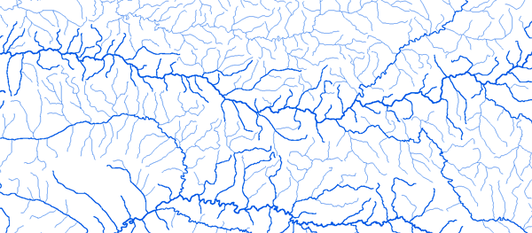
Bassin de la Comoe
|
||||
|
|
||||
|
RAPPEL : Le téléchargement de données est libre moyennant un enregistrement sur ce site et l'édition et le renvoi de la déclaration de l'utilisateur signée.
|
||||
|
|
||||
|
La Comoe |
 |
|||
|
Akakomoekrou 3°30'45"W 7°26'57"N |
 |
 |
 |
 |
|
Aniassue Pont 3°41'12"W 6°38'42"N |
|
|
|
|
|
Diarabakoko 4°47'00"W10°29'45"N |
|
|
|
|
|
Douna 5°07'00"W 10°38'01"N |
|
|
|
|
|
Folonzo 4°36'24"W9°52'43"N |
|
|
|
|
|
Fourkoura 5°23'00"W 10°18'01"N |
|
|
|
|
|
Kafolo 4°18'00"W 9°34'48"N |
|
|
|
|
|
Mbasso 3°28'48"W 6°07'30"N |
|
|
|
|
|
Serebou 3°56'30"W 7°56'18"N |
|
|
|
|
|
Yendere au Pont 5°04'01"W 10°10'01"N |
|
|
|
|
|
|
||||