|
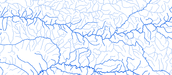
Bassin de la Gambie
|
||||
|
|
||||
|
RAPPEL : Le téléchargement de données est libre moyennant un enregistrement sur ce site et l'édition et le renvoi de la déclaration de l'utilisateur signée.
|
||||
|
|
||||
|
La Gambie |
 |
|||
|
Goulombo 13°44'00"W 13°28'01"N |
 |
 |
 |
 |
|
Kedougou 12°11'00" 12°33'01"N |
|
|
|
|
|
Koussanar 14°05'00"W 13°52'01"N |
|
|
|
|
|
Mako 12°21'00"W 12°52'01"N |
|
|
|
|
|
Missirah Gonasse 13°37'00"W 13°12'01"N |
|
|
|
|
|
Niaoulé Tanou 13°41'00"W 13°29'01"N |
|
|
|
|
|
Pont Tiokoye12°32'00"W 12°34'01"N |
|
|
|
|
|
Pont PNNK 12°44'00"W 13°04'01"N |
|
|
|
|
|
Simenti 13°18'00"W 13°02'01"N |
|
|
|
|
|
Sinthian Coundara Aval 13°55'00"W 13°15'01"N |
|
|
|
|
|
Wassadou Amont 13°22'00"W 13°21'01"N |
|
|
|
|
|
Wassadou Aval 13°23'00"W 13°21'01"N |
|
|
|
|
|
|
||||