|
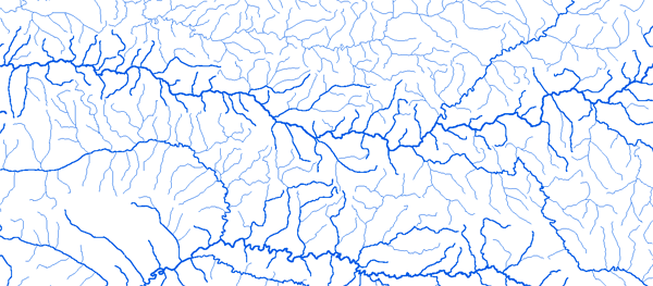
Bassin du Sassandra
|
||||
|
|
||||
|
RAPPEL : Le téléchargement de données est libre moyennant un enregistrement sur ce site et l'édition et le renvoi de la déclaration de l'utilisateur signée.
|
||||
|
|
||||
|
Le Sassandra |
 |
|||
|
Bafingdala (Badala) Biankouma 7°40'00"W 07°50'31"N |
 |
 |
 |
 |
|
Dabala 7°09'36"W 08°25'12"N |
|
|
|
|
|
Guessabo 6°59'00"W 06°44'11"N |
|
|
|
|
|
Guiglo 7°28'08"W 06°32'81"N |
|
|
|
|
|
Ngolodougou 7°37'48"W 08°19'12"N |
|
|
|
|
|
Niamotou 7°32'24"W 08°50'24"N |
|
|
|
|
|
Nibehibe (Nbeigbeu) |
|
|
|
|
|
Semien 7°04'00"W 07°42'30"N |
|
|
|
|
|
Sorotona 7°06'27"W 08°04'47"N |
|
|
|
|
|
Soubre 6°36'47"W 05°47'01"N |
|
|
|
|
|
Vialadougou 7°13'20"W 08°32'36"N |
|
|
|
|
|