The Hydrology of the Oueme, 1963 - J. SIRCOULON et J. RODIER
The Hydrology of the Oueme delta, 1972 - J. COLOMBANI - J. SIRCOULON - F. MONIOD et J. RODIER
The Bandama Hydrology Volume 1 and 2, 1972 Camus H.
The Oubangui basin, 2010 Callède J., Boulvert Y., Thiébaux JP.
Lake Kivu - E. DEVROEY, R. VANDERLINDEN - 1939
Hydrologie de la mare d'Oursi, Burkina-Faso 1976-1981, Chevallier P., Claude J., Pouyaud B., Bernard A.
RIVERS OF MADAGASCAR - P. CHAPERON, J. DANLOUX, L. FERRY ORSTOM - 1993
RIVERS OF GABON - DIVERSITY OF HYDROLOGICAL REGIMES - P. CARRE, ORSTOM - 1978
Niari river basin Hydrology - G. HIEZ, B. BILLON, P. TOUCHEBEUF, P. CHAPERON, ORSTOM - 1965
Likouala Mossaka river Hydrology - J.P. THIEBAUX, ORSTOM - 1987
The Natural Environment of the Ivory Coast - J.M. AVENARD & al, Mémoire ORSTOM - 1971
 The Hydrology of the Nil - J.V. Sutcliffe, Y.P. Parks IAHS Special Publication n°5 1999
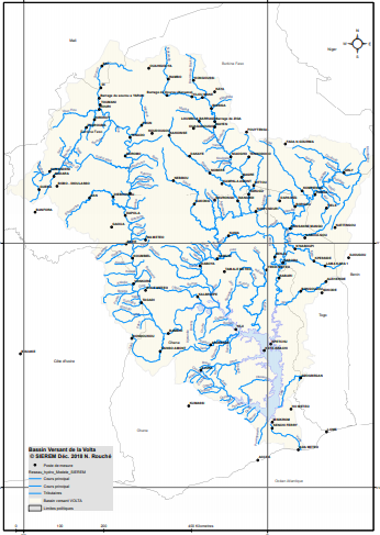
Water Atlas of the Volta Basin - J. LEMOALLE, D. DE CONDAPPA Ird 2009. .
Benin Monography - L. LE BARBE, G. ALE, B. MILLET, H. TEXIER, Y. BOREL, R. GUALDE Orstom 1993.
Mejerdah river Monography - J.A. RODIER, J. COLOMBANI, J. CLAUDE, R. KALLEL Orstom 1981
Sanaga river Monography - P. DUBREUIL, J. GUISCAFRE, J. F. NOUVELOT, J.C. OLIVRY Orstom 1975.
Chari river Monography - B. BILLON, J. GUISCAFRE, J. HERBAUD, G. OBERLIN Orstom 1974.
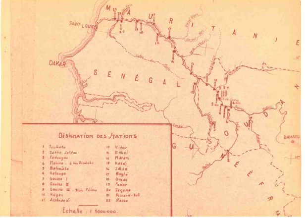
Senegal river Monography - C. ROCHETTE Orstom 1974.
HYDRLOGICAL GAMBIA RIVER MONOGRAPHY - J.P. LAMAGAT, J. ALBERGEL, J.M. BOUCHEZ, L. DESCROIX.
CAPE VERDE Hydrology - Sao Nicolau island study - J.C. OLIVRY ORSTOM - 1987.
Niger River monography - Inner delta - C. AUVRAY Ingénieur EIH Directeur de Recherche ORSTOM - 1960.
Niger River monography - Brunet-Moret Yves, Chaperon Pierre, Lamagat Jean-Pierre, Molinier Michel.
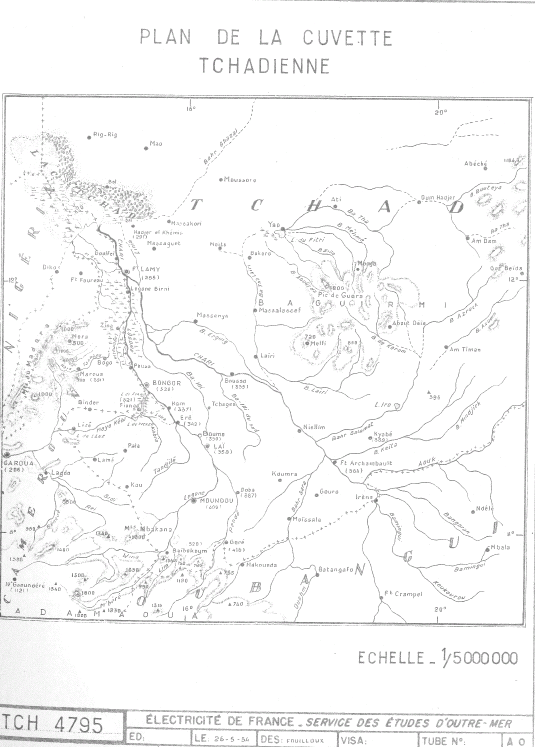
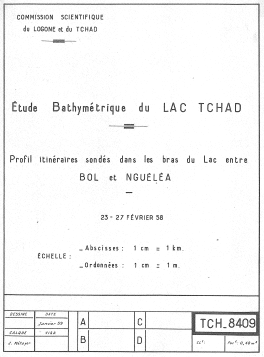
Hydrologie du lac Tchad - Olivry Jean-Claude, Chouret Alfred, Vuillaume Gabriel, Lemoalle Jacques, Bricquet Jean-Pierre.
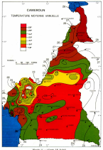
Fleuves et rivières du Cameroun - Olivry Jean-Claude
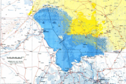
Hydrological survey of the Wabi Shebelle Basin - BCEOM - ORSTOM - EDF - IGN - BDPA 1973
Monographie hydrologique du bassin de la Volta - MONIOD FRÉDÉRIC, POUYAUD BERNARD, SÉCHET PATRICK.
BULTOT, F. et DUPRIEZ, G.I. Levels and flows of the Zaire River in Kinshasa (Regime - Variability - Forecasting) 1987
DU SOLEIL. Meteorological yearbook Belgium Congo and Ruanda-Urundi
Senegal river water level 1952
DEVROEY E.-J. Hydrological yearbook Belgium Congo and Ruanda-Urundi
Collections of data for representative and experimental basins
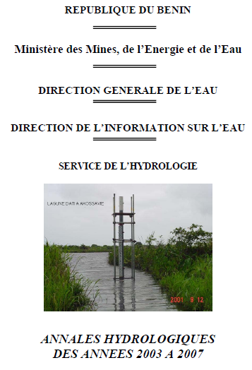
Benin Hydrological Yearbook
Burkina Faso Hydrological Yearbook
Cameroon Hydrological Yearbook
Central African Republic Hydrological Yearbook
Congo Hydrological Yearbook
Ivory Coast Hydrological Yearbook
Gabon Hydrological Yearbook
Kenya Hydrological Yearbook
Madagascar Hydrological Yearbook
Mali climate Yearbook
Mali Hydrological Yearbook
Niger Hydrological Yearbook
Rwanda Hydrological Yearbook
Tchad Hydrological Yearbook
Togo Hydrological Yearbook
Tunisie Hydrological Yearbook
Tunisie rainfall Yearbooks
Limnimetric observations, Kinshasa, Matadi, Boma
Annales hydrologiques de l'Office de la Recherche Scientifique et Technique Outre-mer
Annuaires hydrologiques de la France d'Outre-Mer
RÉGIMES DES PRÉCIPITATIONS ET RELATIONS PLUIES-NIVEAUX D’EAU-DÉBITS DANS LE BASSIN VERSANT DU KOMO (GABON)
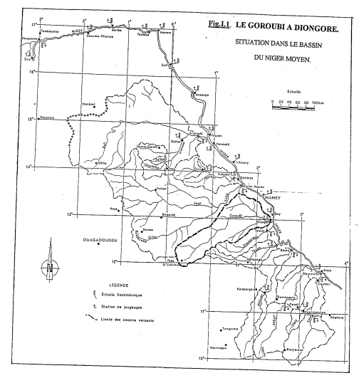
Contribution to the hydrological study of Goroubi at Diongore watershed, Niger. Daouda ABDOURHAMANE - 1995
Contribution to the study of the impact of climatic variability on water resources in west Africa. Consequences analysis of a persevering drought : hydrological normals and regional modelisation - Mahaman OUEDRAOGO - December 2001
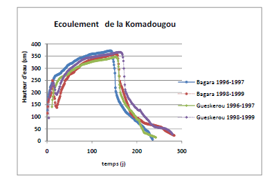
Analysis and modeling Komadougou Yobé in its nigerian part (1996-2008)
Hydrological monography Grand Bale bassin at Pa, Burkina Faso
Rainfall Atlas maps Mauritania, Gambia and Senegal from 1947 to 2003 for a monitoring spread of borreliosis
Vulnerability of superficial water resources on a soudano-sahelian watershed, in a climate changing context: study with indicators.
Prévision des ressources en eaux en Afrique de l'Ouest et Centrale jusqu'en 2099 par application des sorties du modèle d'évolution du climat HadCM3 au modèle hydrologique GR2M.
Rainfall-Runoff Monthly Modelling/ Spatialisation contribution - Soil data case
Prise en compte des spécificités de l'évapotranspiration en zone semi-aride dans la modélisation globale de la relation Pluie-Débit
Results of 50 years of weather observations - Nicolas Aguinet - Mai 1997.
Water balance of Zaire river - ONRD 1971
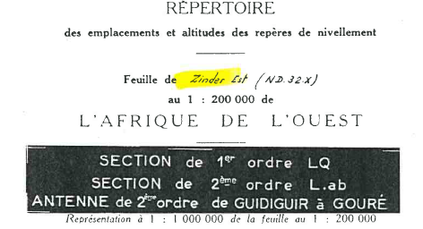
Locations and altitudes benchmark of Zinder Est Niger - IGN 1958
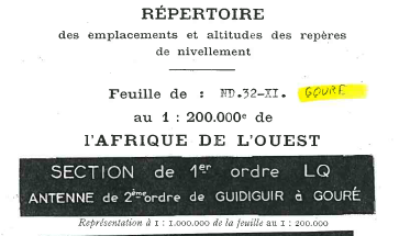
Locations and altitudes benchmark of Gouré Niger - IGN 1958
NOTE ON CONGO FLOOD HEIGHTS - EDF ORSTOM - April 1962
DAM PROJECT ON THE SIRBA AT BASIERI - Hydrological Elements - Pierre CHEVALLIER- ORSTOM 1979
The development of Lake Chad: current situation and possible future - Jacques LEMOALLE et Géraud MAGRIN - IRD 2014
General directory of hydrometric stations in the Central African Republic - ORSTOM - 1972
Catalog of daily flows available in SIEREM for 16 West and Central African countries - Nathalie Rouché - 2016
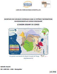
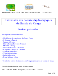
Inventory of SIEREM available data on Congo basin - Nathalie Rouché - 2016
Assessment and inventory study of the surface water resources of GUINEA BISSAU - Jean ALBERGEL & Yannick PEPIN - 1990
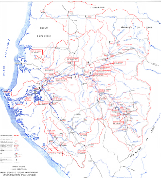
The Congolese Hydrological Basin - Especially the Sea Bief - E. DEVROEY
Hydrology and Water Balance of the Karuzi Watershed in Burundi - A. BODEUX 1972
THE RAIN INTENSITY IN THE CONGO AND RUANDA-URUNDI - J. PIRE, M. BERRUEX,J. QUOIDBACH 1960
Oubangui watershed documents - N.Rouché 2016
Inventory of variables available in SIEREM for Goulbi Basin Maradi, Niger - N.Rouché 2016
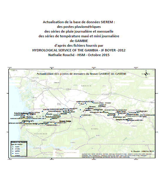
Update of the SIEREM database: rainfall stations, daily and monthly rainfall series and daily maximum minitemperature series for GAMBIA
Notes on hydrological data on the basins of the Logone, the Kabia, Loka and Tandjile - Bouchardeau A. 1948-1949
Notes and reports on Lake Chad and Bahr el Ghazal
Total annual rainfall synoptic and rainfall stations Centrafrique - - J. CALLEDE. Y. LE TROQUER
Kasai river and his hydrographical watershed - E. DEVROEY - 1939
Discharges selected rivers of Africa - UNESCO/IHP - 1995
Management and conservation of the African great lakes - Lakes Victoria, Tanganyika and Malawi - Ruud C. M. Crul - UNESCO/IHP - 1998
Limnology and hydrology of Lake Victoria - Ruud C. M. Crul - UNESCO/IHP - 1995
Limnology and hydrology of Lakes Tanganyika and Malawi - Ruud C. M. Crul - UNESCO/IHP - 1997
World Bank - Hydrological Assessment of Sub-Saharan Africa - Countries of West Africa
MAURITANIA - Feasibility study of manual drillings
Irrigation Mauritanian experience Example floods spreading
Gorgol hydrological study - J. Hoorelbeck 1979
Senegal planning Mission - Gorgol Campaign - 1958
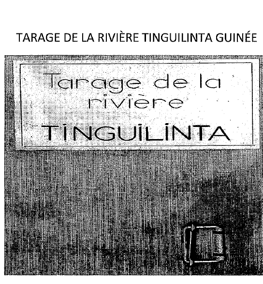
Tinguilinta river study - Guinea - may 1958
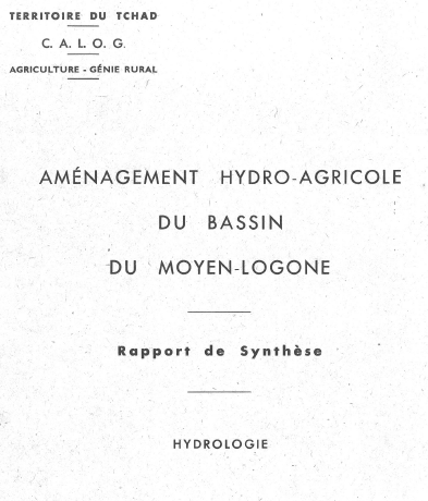
Hydro-agricultural Layouts middle Logone - Chad - mars 1956
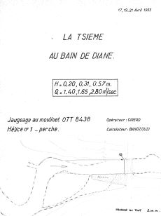
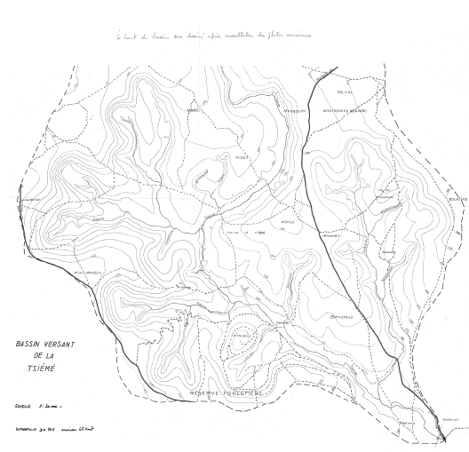
TSIEME watershed at Brazzaville
EQUANIS final report - Hydrological part - may 1998
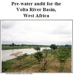
Pre-water audit for the Volta River Basin, West Africa - Bart J.M. July 2005
Diagnostic analyse of the Niger river watershed - Ahmed Oumarou, Rouscoua Boubacar june 2001
Notes minimum and maximum - Oubangui - J. Yayer 1951
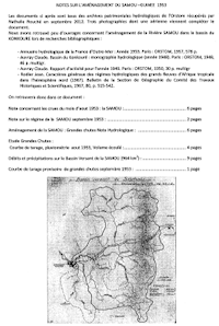
Notes on Samou planning - Guinea
Limnimetric stations of the Congo Republic - J.C. Olivry G. Hiez - ORSTOM 1967
Directory of the altitudes of the flood scales located in the Niger River Valley in the Republic of Niger - IGN - 1980.
Congo hydrometric data inventory
Notes on processing monthly rainfall data files for creating reference monthly rainfall series - Nathalie ROUCHE - 2012.
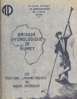
The limnimetric station of the lower Niger river - Brigade Hydrologique de Niamey - 1957.
The hydrometric stations of the upper Senegal river - DRHE - ORSTOM - 1977.
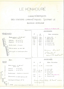
KONKOURE River : limnimetric station features - statement at 12/31/1953.
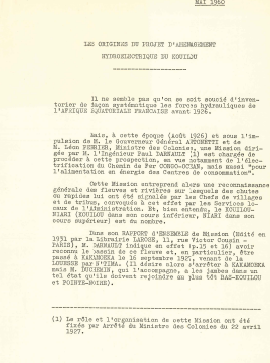
The origins of the Kouilou hydroelectric project - May 1960 23 pages.
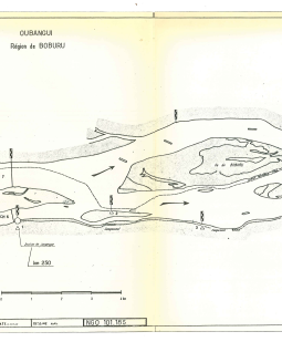
Boburu island Congo Oubangui basin
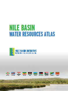
Nile Basin Water Resources Atlas - Nile Basin Initiative (NBI)- 2016
 NIGERIA - Hydrological area sub-division - Jean Pierre Debuiche - IRD 2005
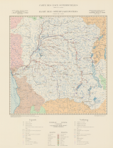
GABON - Watersheds and Hydrographic network
SIEREM Collection of Watershed Maps by Nathalie Rouché
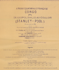
Hydrographical map of Stanley Pool - CONGO - Roussilhe - 1911
Hydrological and pastoral hydraulic maps of north Dori - J.Lemoine - 1954
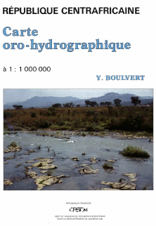
Oro-hydrographic map of the Central African Republic - Yves BOULVERT 1987
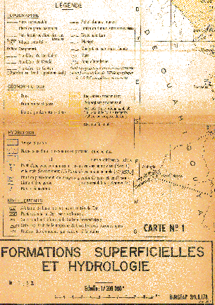
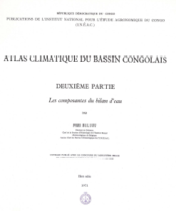
Climate atlas of the Congolese basin. Part 2, The components of the water balance - Franz Bultot 1971
Maps of water surface in the Congo Basin - compiled by DEVROY, E-J 1950
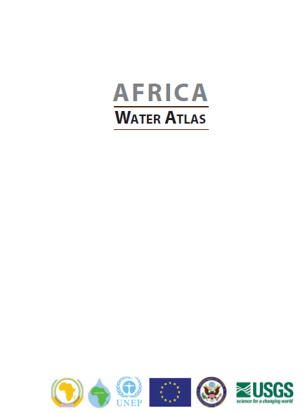
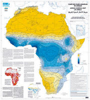
Africa Water Atlas - 2010, United Nations Environment Programme
Population and land management Atlas - Mali - 2004
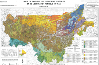
Synthesis map of vegetation and agricultural occupation in Mali - 1/1 000 000 - 1991
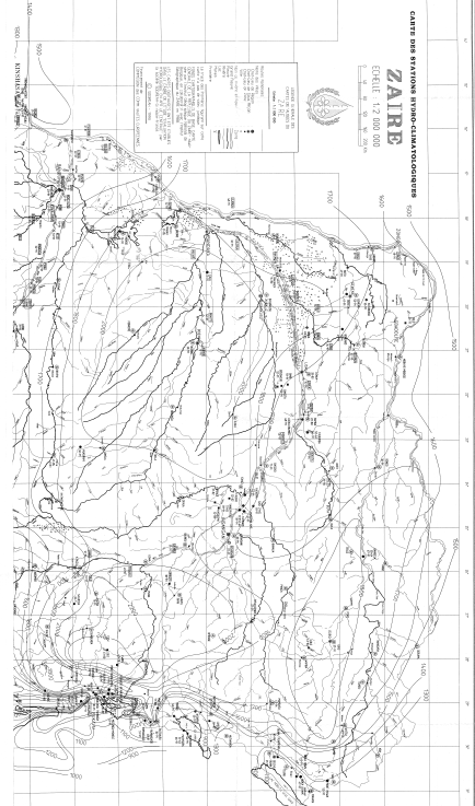
Hydro-climatic station map - Zaire 1993
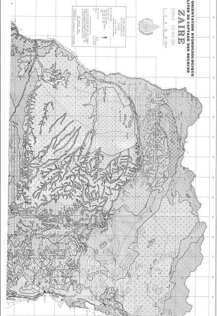
Orientation diagram of Hydrogeology - Zaire 1993
Hydrological Atlas of Mauritania - 1981
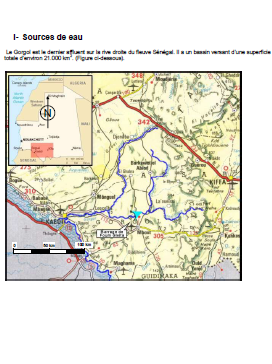
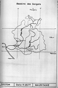
Situation map of the hydrological stations - Basins Gorgols - 1977
Map of the Tsieme Basin 1.20 000th
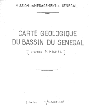
Geological map of the Senegal Basin 1.2 500th - according to P. MICHEL
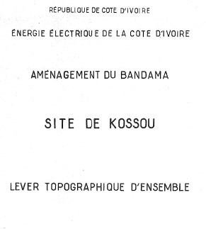
Planning BANDAMA - site KOSSOU 1/5 000 - Sept 1961
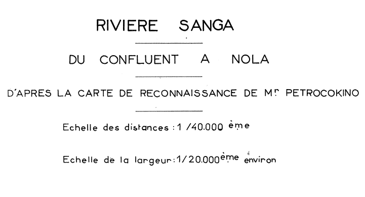
Sanga River from confluence to Nola - according to the reconnaissance map of Mr Petrocokino
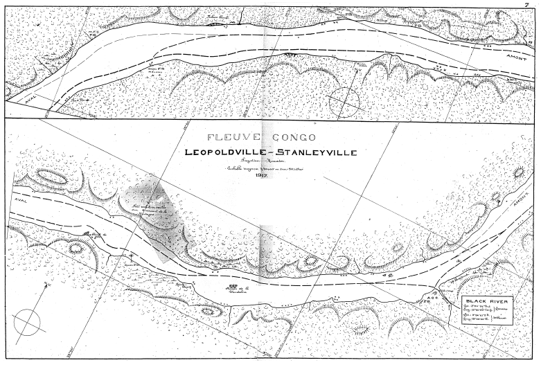
Congo river map from Kinshaha to Kisangani - 1917
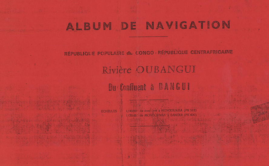
Navigation album of the Ubangi river from the confluence to Bangui - 1965
Navigation album of the Congo river from Brazzaville to the confluence with the Ubangi - 1963
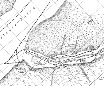
Album of the Kasai River navigation from Maleka-Kwa to Ilebo - 1982..
Map of annual rainfall in Africa
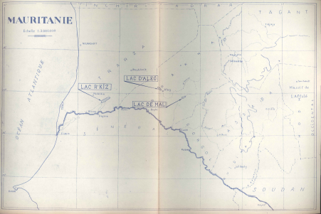
Situation map of R’kiz, d’Aleg, and Mal lakes.
French equatorial Africa Map. Sheet II
Guide des pratiques hydrologiques, 6e ed. 2014, Publication 168, OMM Genève
Guide to climatological practices, Edition 2011, Publication 100, OMM, Geneva
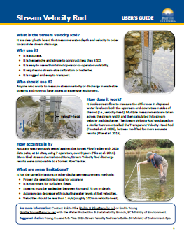
Stream Velocity Rod - USER’S GUIDE - British Columbia
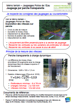
Field memo - Transparent pole gauging - AGENCE FRANCAISE pour la BIODIVERSITE
Quality charter for hydrometry - Guide to good practice - Schapi 2017
Floods and inputs - 1996, 262 p. (Bulletin FAO d'Irrigation et de Drainage ; 54). ISBN 92-5-203874-4
Estimation of ten-year flood flows for watershed area less than 200 km² in West Africa - J. RODIER and C. AUVRAY
HYDROLOGICAL PRACTICAL GUIDE ON SMALL RURAL WATERSHED IN TROPICAL AND EQUATORIAL AFRICA - J.F. NOUVELOT
Automatic processing of hydrometric and pluviometric data in the hydrological service of ORSTOM. Marcel ROCHE -1968